
Site appraisal
Draw a line. Get the whole picture back.
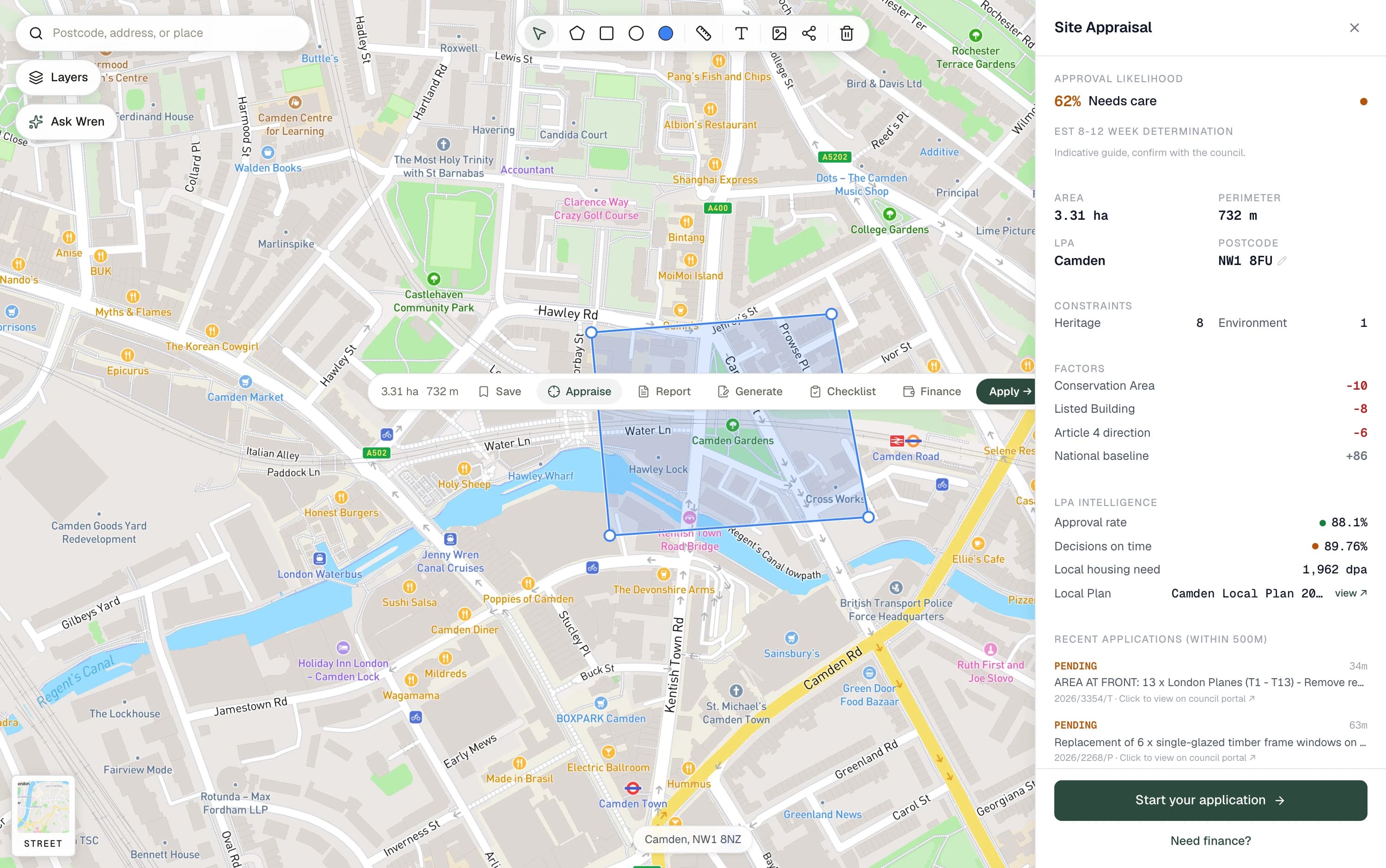
Area and perimeter, the authority, every constraint that touches the line, the factors that move the decision either way, that council's own approval rate, and the applications already lodged within 500 metres.
- Layers checked against your boundary
- 88Layers checked against your boundary
- To run one, with no card
- £0To run one, with no card
- Free credits when you sign up
- 25Free credits when you sign up
- Time to a full appraisal
- Same dayTime to a full appraisal
What comes back
Every layer a planning officer will look at.
The appraisal does not summarise the constraints. It resolves each one against the geometry you drew, states whether it touches the line or merely sits nearby, and names the dataset it came from with the date that dataset was last refreshed.
Where a constraint is genuinely bad it says so. A tool that only ever returns good news is a tool nobody can plan around.
The sequence
Four steps, and three of them are ours.
- 01
You draw the boundary
A polygon on the map. Snap it to a title boundary or draw it freehand.
- 02
We resolve the constraints
All 88 live layers tested against your geometry, not against your postcode.
- 03
We name the route
Householder, minor, major, prior approval or certificate, and why that one.
- 04
We price the set
The documents that route requires, and the council fee that goes with it.
Judgement, not just data
What actually moves a decision.
The constraints are facts. The likelihood is a judgement, and it is shown with the factors that produced it rather than as a bare score, because a number you cannot interrogate is worse than no number at all.
- Constraints
- What touches the line
- Designations, flood risk, protected trees, heritage assets and article 4 directions, each traced to its publisher.
- Precedent
- What this council has already decided
- Applications determined within 500 metres, with their outcome and how long each one took.
- Policy
- What they will decide against
- The adopted local plan policies engaged by your scheme, with the passage that applies.
- Requirements
- What they will insist on
- Your authority's own published validation list, not a national template.
The fastest way to understand a site is to draw on it.
Put a line around any site in the country and watch what comes back. It takes about fifteen seconds and costs nothing.